Brest pod Učkom

Brest pod Učkom is a quaint village located entirely within the borders of Učka Nature Park at a height of 708 metres above sea-level amidst a fertile field on the Ćićarija plateau.
The people here were once famous for producing charcoal. The forest was their main source of income: it provided the firewood for their homes, but also for producing charcoal, which they would then sell in Opatija, Rijeka, Lovran and other places along the coast.
In addition to arable farming and cattle-breeding, the main occupation of the local people was the production of charcoal in piles called “karbunice”, from which even today one can see smoke rising.
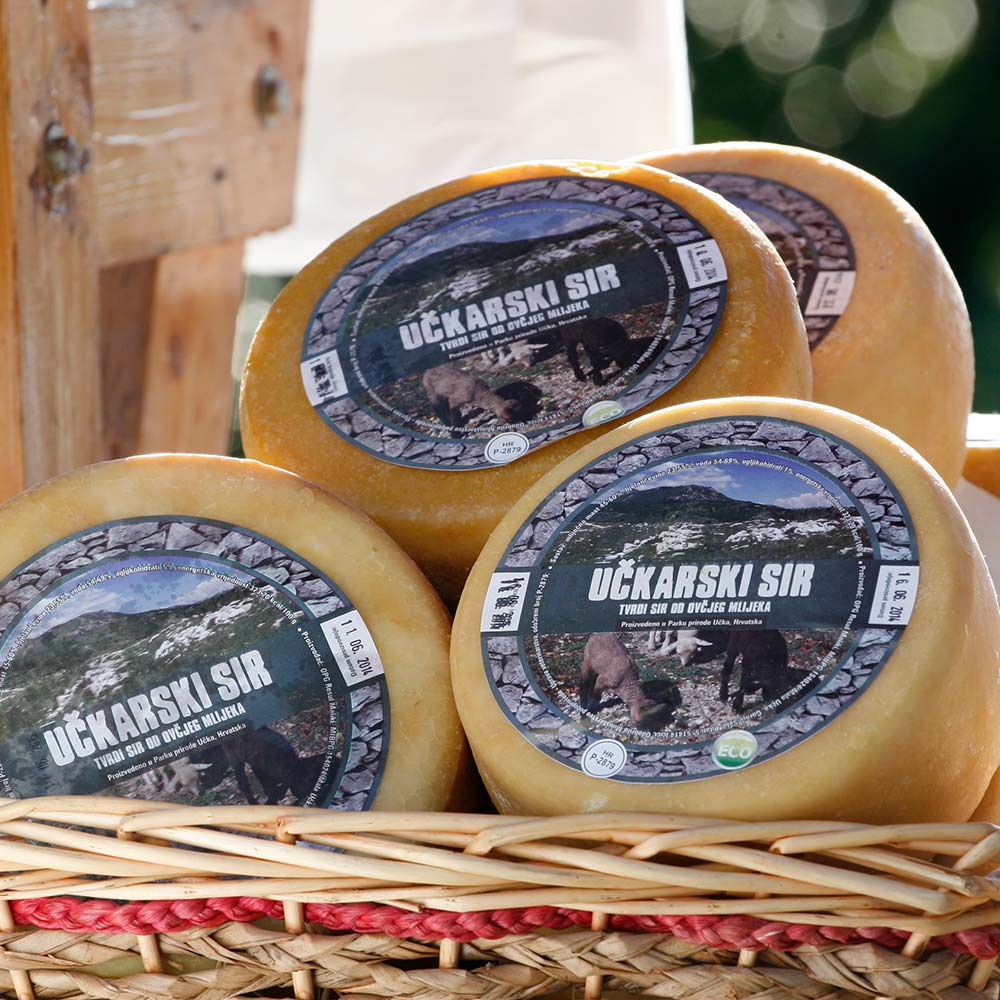
To sample or buy some home-made sheep’s milk cheese, ask local people for the Rumac brothers. These brothers make their cheese and curd cheese from the milk of the indigenous Istrian sheep breed called pramenka, and their flocks graze freely on the pastures of Ćićarija.
Brgudac

The quaint village of Brgudac is located in the heart of the Ćićarija mountain range at an elevation of 747 m above sea-level, which makes it the highest permanent settlement in Istria. This place, whose history dates back to the Middle Ages, used to teem with life: in the past, more than 400 people lived here, and had up to 3,000 cattle. But due to its later economic conditions and turbulent history, Brgudac’s people had to scatter all over Croatia and abroad. Many of them, however, return here regularly to take care of their heritage and preserve the beauty of this village.
During World War Two, Brgudac was the centre of partisan activities in Istria, and is remembered for the suffering and heroism of it people. On the 10th of October 1942, the first rural people’s liberation committee (a self-government body) was founded here, and in December 1943, Brgudac had the first Croatian school in Istria after the fascist ban from 1923. Today a dozen memorials remind visitors of this hard period, most striking being the one that memorises 19 murdered partisans and 37 civil victims of the fascist terror.
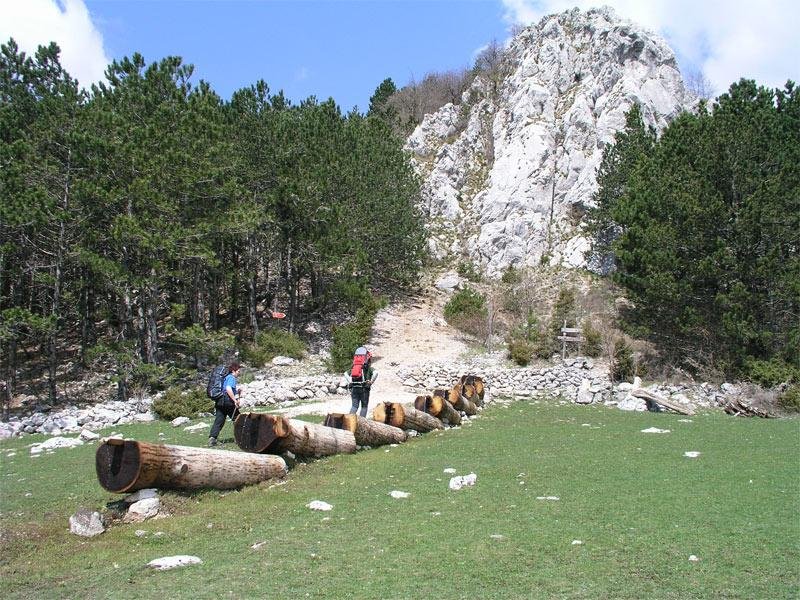
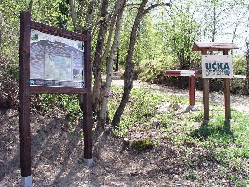
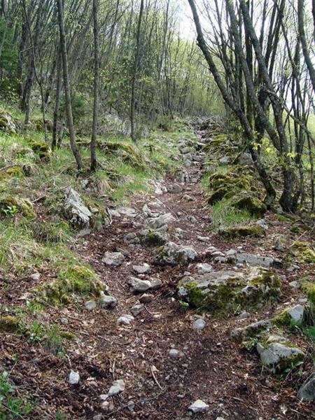
Brgudac is the starting point for a hiking route that leads to the Korita water source area and further on to the peak of Veli Planik.
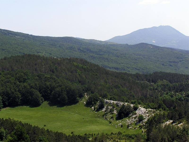
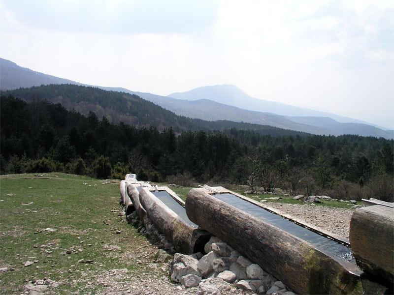
Korita

The jewel of the Ćićarija mountain range
The source of Korita lies at 45 minutes’ walking distance from the village of Brgudac. It can be reached on a path that leads through a dense hornbeam and oak forest, with an occasional spruce and many protected plants and animals.
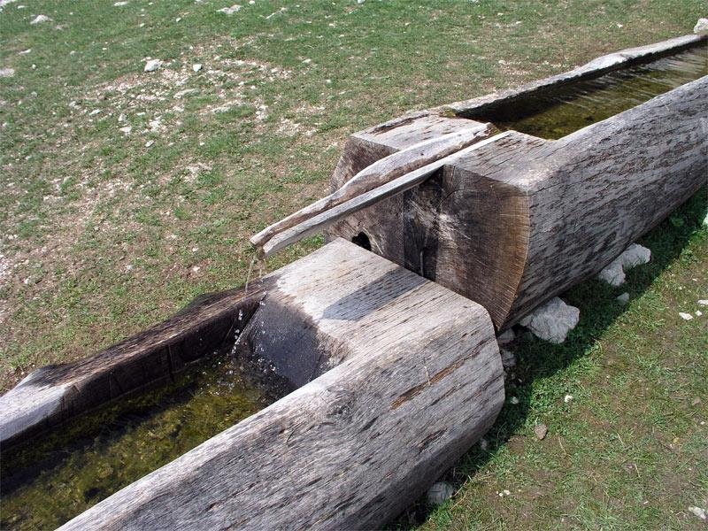
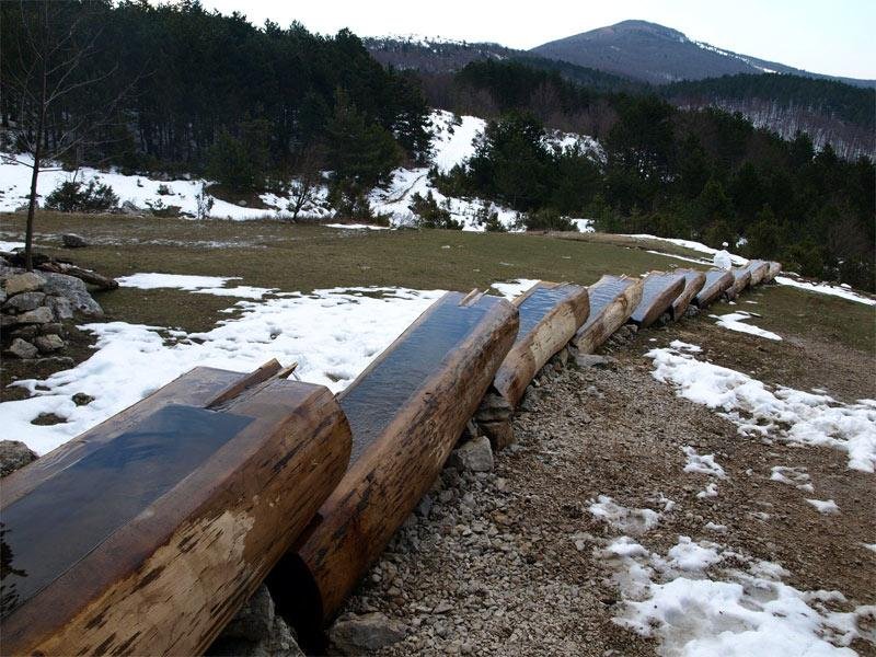
Located in a meadow under the Brajkova stijena cliff, this source of drinking water pours into ten solid wooden troughs, beneath which is a rather large pool rich in plant and animal life. This facility played a very important role in the life of local people because it was a major water source for them and their cattle.
A rest area at the source offers a wonderful view of the Učka massif. Interpretation boards explain the cultural and natural significance of this spot.
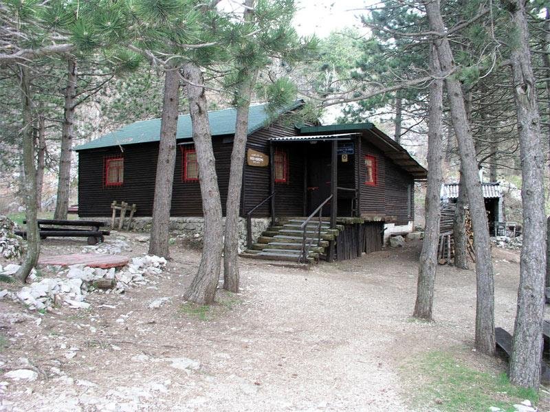
Not far from the source is the Na Koritima mountain hut, which at weekends offers accommodation and refreshments.
If you intend to stay overnight in the hut, we recommend first checking its availability with the Glas Istre mountaineering club.
tel: +385 98 701 535
Kožljak

The medieval castle of Kožljak (210 m), built on a steep cliff above the former lake of Čepić, which was eventually drained and is today a fertile field, was first mentioned in some documents dating from the beginning of the 12th century. The preserved stone steps, which even today seems to echo the clatter of hooves and rattling of armour, and parts of the defensive walls are reminders of those troubled times. A series of coats of arms chiselled into the rock attests to changing owners and rulers throughout the centuries.
To visit Kožljak, take the road that leads from Vranja to Šušnjevica and continue towards Kožljak.
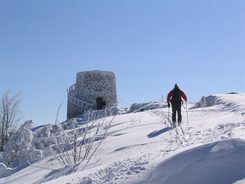
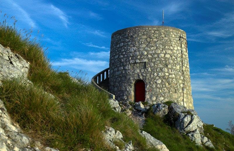
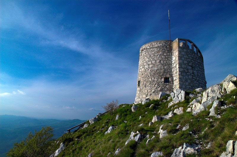
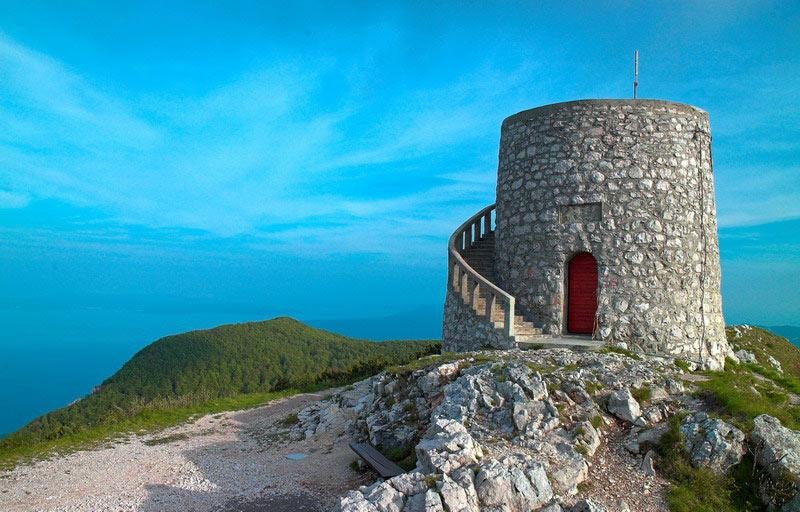
The Vojak Tower

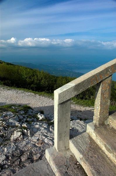
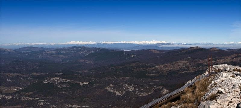
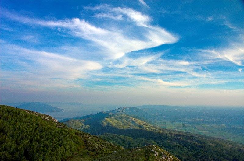
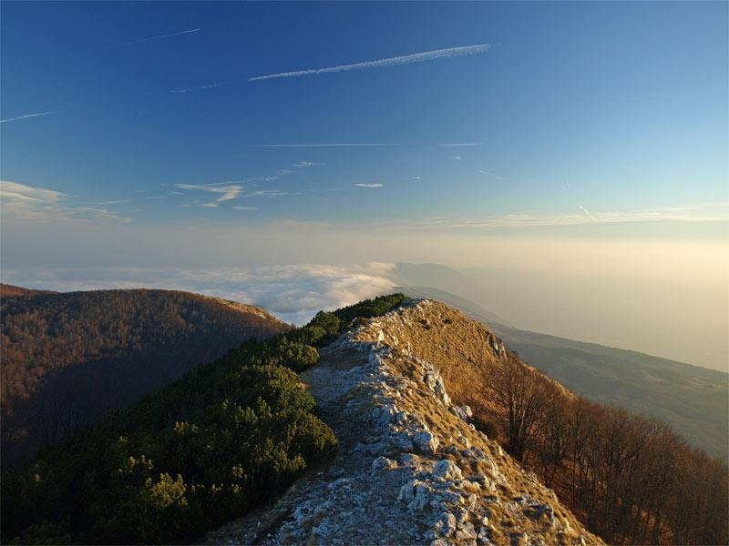
Vojak is the highest peak in Učka Nature Park; it is also the highest peak on the Istrian peninsula, rising 1,401 metres above sea level.
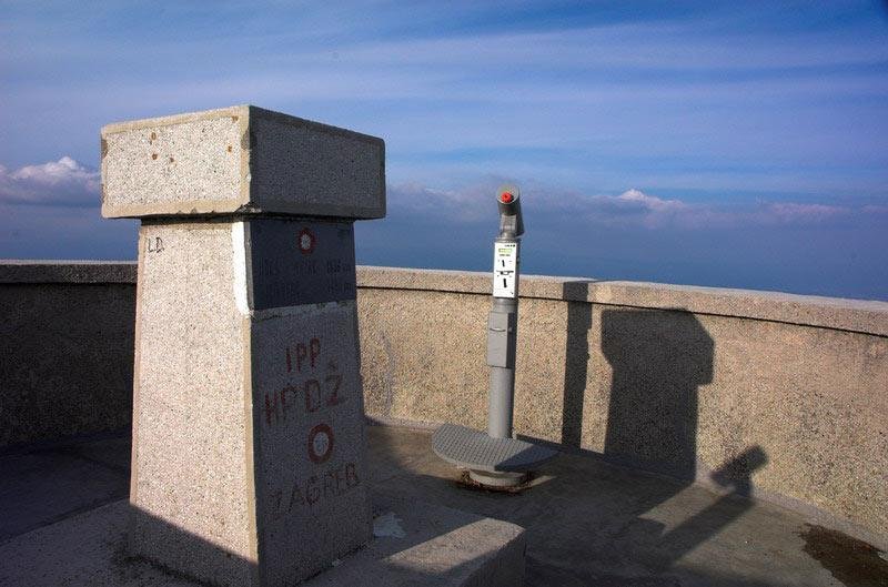
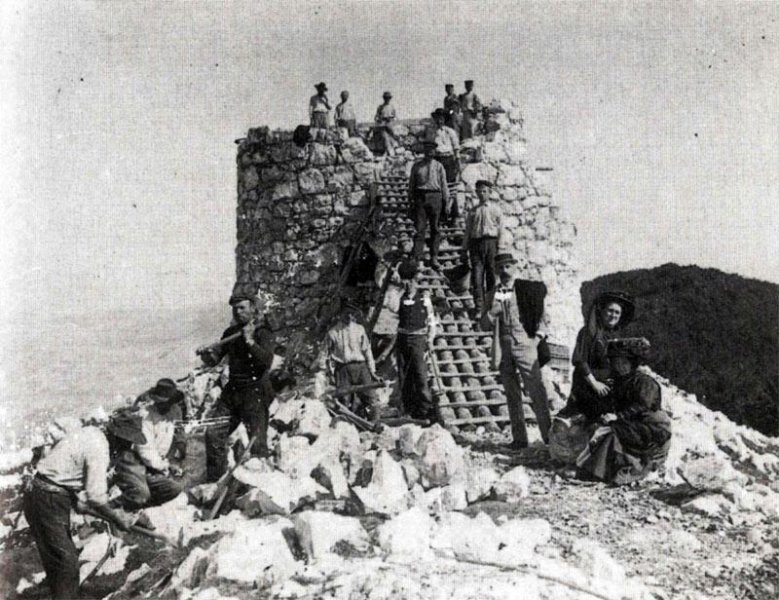
The Vojak Tower was built in 1911 to benefit from the mountain’s wonderful panoramic views of Istria, the Kvarner Bay with the islands, the mountains in the Gorski kotar area, Mount Velebit, the Alps, and Italy. The tower was built by mountain climbers and nature enthusiasts from the Österreichischer Touristen Club in the Austro-Hungarian period. During World War I, it served as an Austro-Hungarian military and naval lookout post.
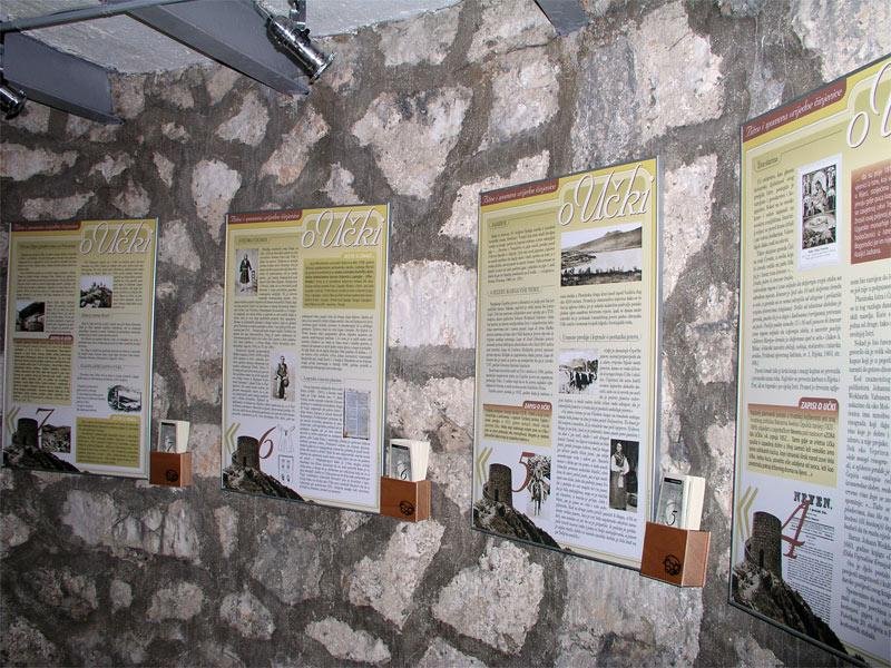
After the massif of Mount Učka and one part of Ćićarija mountain range were declared the Učka Nature Park in 1999, the Vojak Tower became the symbol of the park. To preserve the area’s cultural and historical heritage and the long tradition of climbing to Učka’s highest peak and observation tower, as well as to make the most of the splendid panoramic views, the Učka Nature Park Public Institution renovated the tower completely in 2004. Today, the tower includes an information office, a souvenir shop and an observation deck equipped with telescopes offering magnificent views of the surrounding landscapes.
The following routes are recommended for climbing Vojak:
Poklon – Vojak
Vela Učka – Sedlo – Vojak
Mala Učka – Sedlo – Vojak
Lovranska Draga – Mala Učka – Vojak
Lovranska Draga

Lovranska Draga is a picturesque village located within the borders of Učka Nature Park on the eastern slopes of Mount Učka. Until around twenty years ago, its local people engaged intensively in agriculture, especially wine-growing, cattle-breeding, and sheep farming. In addition to vines, the area’s fertile soil was also used to produce different types of fruits and vegetables, predominantly cherries and sweet chestnuts. The small, scattered houses are connected by a network of ancient paths, the most important being those that lead from this rural hinterland of Lovran to Medveja and the sea.
In the past, the women of Lovranska Draga would walk these paths every day carrying firewood, milk and vegetables to Lovran. At the entrance to Lovranska Draga is the small baroque church of St. Michael, patron saint of the village. The church is surrounded by terraces with vineyards and meadows. Together with the peak ridge of Mount Učka in the background, this place makes up a particularly valuable landscape. A stream, locally called simply Potok (which means stream or brook in Croatian), runs through the village and flows into the sea in Medveja. The most interesting part of this stream is its waterfall, one of the most beautiful waterfalls in Učka Nature Park. It can be reached on the marked Slap educational trail(Slap means waterfall in Croatian).
On the 29th of September, local people celebrate the feast of St. Michael, the patron saint of Lovranska Draga.
On this feast day, Lovranska Draga hosts a folk festival where visitors can enjoy one of the traditional dishes of the region – turnip and beans.
Did you know?
In the Lovranska Draga area, at the site called Oporovina, remnants of prehistoric man were found in 1929. This was the first prehistoric site on Kvarner.
Mala Učka

Mala Učka is the highest rural settlement in Istria, located at an elevation of 995 metres above sea-level.
In the past, this village used to have 130 inhabitants (locally called Učkari) who engaged in cattle breeding and were famous for their high-quality cheese.
During World War Two, on the 30th of April 1944, Italian and German soldiers burned down the entire village. After the war, the remaining inhabitants moved out due to the harsh economic situation. Despite this, the village remained so quaint and picturesque that it was listed in the Registry of immovable cultural monuments in 1976 as a protected rural unit. Today the village of Mala Učka has no permanent residents, but every year in the summer months, the Maliki, a shepherding family, come back to take full advantage of the area’s high-quality pasturing. Visitors can buy some excellent sheep’s milk cheese and curd cheese at their house.
The diversity of Mala Učka’s flora and the beauty of its relief and rural landscape, with the village surrounded by mighty rocks and pastures, represent an extraordinarily valuable natural heritage. To reach the village, take the gravel road from the village of Vela Učka.
Trebišća (Trebischia)

Only 3 km from the summer crowds on Mošćenička Draga beach lies the hamlet of Trebišća, which used to be particularly beautiful in the past. It is hidden deep in the green shade of a canyon cut out by a local stream, the Potok. The reason why this place was located in this inaccessible valley, where the sun hardly shines in winter, can be found in the ruins of the local mill. Written documents about its existence date back to the Middle Ages, and older local people still remember the times when this whole area used to bring corn there for milling.
The mill was set on fire at the end of World War Two and was never restored, because of technical progress. As a result, Trebišća lost its importance and gradually became a town without permanent residents. However, thanks to the care of people who were born here, this hamlet remains well-preserved, frozen in time like the sleeping beauty.
The hamlet of Trebišća hides another mystery, which is explained in more detail on the Trebišća-Perun history and mythology trail.
Vela Učka
Vela Učka is a rural settlement on the highest slopes of Mount Učka. It is located at an elevation of 950 metres above sea-level, which makes it the second highest settlement in Croatia.
We recommend that you leave your car in Vela Učka and take a 3.5-km walk through the village towards the abandoned village of Mala Učka. This is a perfect opportunity to directly experience the rural life on Učka and to enjoy some magnificent views of the Istrian slopes and Učka’s peak ridge.
Water of Joseph II Fountain

The “Water of Joseph II” is located in a small rural settlement called Vela Učka, on the western slopes of Učka Nature Park.
The style and the dimensions of the facility create the impression of a fountain, which is how it is mostly known by the local people. In the folk tradition it was also called “Napoleon’s water”.
The old “pipe”, with its beauty and patina of times gone by, has always attracted the attention of Učka’s inhabitants and the travellers who have been stopping by for centuries to refresh themselves from its fresh spring water.
Today, due to its monumentality and cultural features, it is considered a cultural heritage of special importance.
Based on the style of the building, it is presumed that the fountain was built during the reign of the Habsburg Monarchy, at the time when the road over Učka was constructed. Most of the large number of people that inhabited Učka at that time were involved in cattle breeding and agriculture and therefore this facility was used by them as a place to rest and water their animals. This fact was confirmed by an inscription revealed during the monument’s restoration in which the name of Emperor Joseph II of Lorraine appears, the sovereign of the Monarchy from 1780 to 1790.
The inscription reads:
….sule Viator …. traveller!
ad dignitatem in honour of
Divi Caesaris Josephi II the divine Emperor Joseph II
Imperatoris sole
uninsque…… emperor
RESTORATION AND PROTECTION
The fountain was renovated to mark the occasion of International Year of Freshwater in 2003 as part of the cultural heritage protection programme run by the Učka Nature Park Public Institution in collaboration with the relevant administrative department for the protection of cultural heritage at the Conservatory Department in Rijeka and the sculptor Zvonimir Kamenar.